Welcome, Kapamilya! We use cookies to improve your browsing experience. Continuing to use this site means you agree to our use of cookies. Tell me more!
Chedeng unlikely to bring heavy rainfall into PH in next 3 days: PAGASA
ABS-CBN News
Published Jun 08, 2023 06:52 AM PHT
|
Updated Jun 08, 2023 06:56 AM PHT
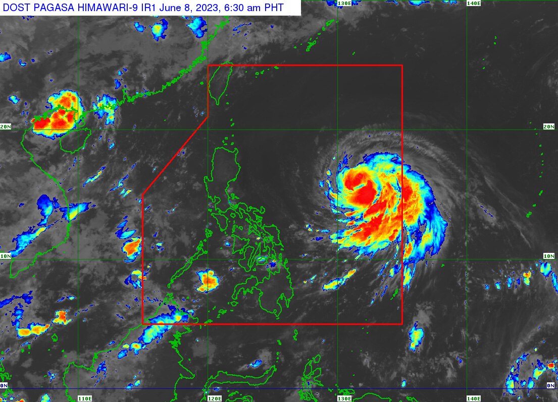
PAGASA image
MANILA - Severe tropical storm Chedeng is unlikely to bring heavy rainfall to the Philippines in the next 3 to 5 days, the state weather bureau said early Thursday morning.
In its 5 a.m. weather advisory, PAGASA said Chedeng was last sighted approximately 1,090 km east of Central Luzon packing maximum sustained winds of 95 kph near the center with 115 kph gusts.
Strong to gale-force winds were extending around 350 km from the center of the storm, PAGASA said.
The weather agency said that even if the severe tropical storm is projected to enhance the southwest monsoon (habagat), the timing and intensity of monsoon rains over the Philippines "may still change due to the dependence of monsoon enhancement on the forecast movement and intensity of Chedeng as well as its interaction with the other weather systems surrounding it."
ADVERTISEMENT
PAGASA also said hoisting of tropical wind signals is not foreseeable at present.
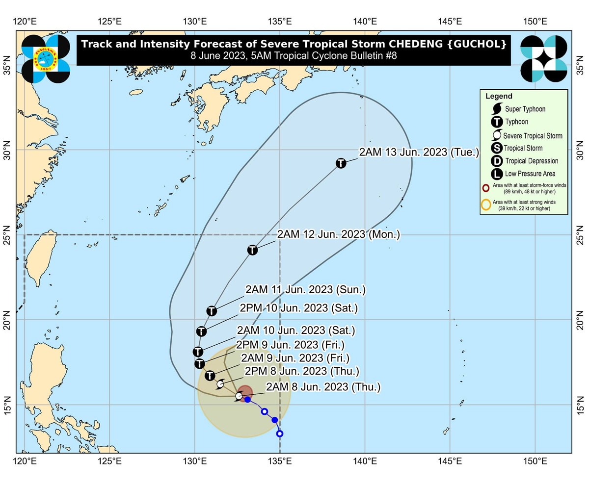
PAGASA image
On Friday, the habagat's enhancement may cause gusty conditions over the Visayas, Romblon, Occidental Mindoro, the northern portion of Palawan including Kalayaan, Calamian, and Cuyo Islands, Surigao del Norte, Dinagat Islands, and Camiguin.
On Saturday, the monsoon is expected also bring the same conditions to the Visayas, Calabarzon, Mimaropa, Bicol Region, Camiguin, and Dinagat Islands.
ABS-CBN is the leading media and entertainment company in the Philippines, offering quality content across TV, radio, digital, and film. Committed to public service and promoting Filipino values, ABS-CBN continues to inspire and connect audiences worldwide.
Our website is made possible by displaying online
advertisements to our visitors. Please consider supporting
us by disabling your ad blocker on our website.
Our website is made possible by displaying online
advertisements to our visitors. Please consider supporting
us by disabling your ad blocker on our website.