Expect heavy rains until Monday in parts of Luzon as Dodong leaves PAR
ADVERTISEMENT

Welcome, Kapamilya! We use cookies to improve your browsing experience. Continuing to use this site means you agree to our use of cookies. Tell me more!
Expect heavy rains until Monday in parts of Luzon as Dodong leaves PAR
ABS-CBN News
Published Jul 15, 2023 05:33 PM PHT
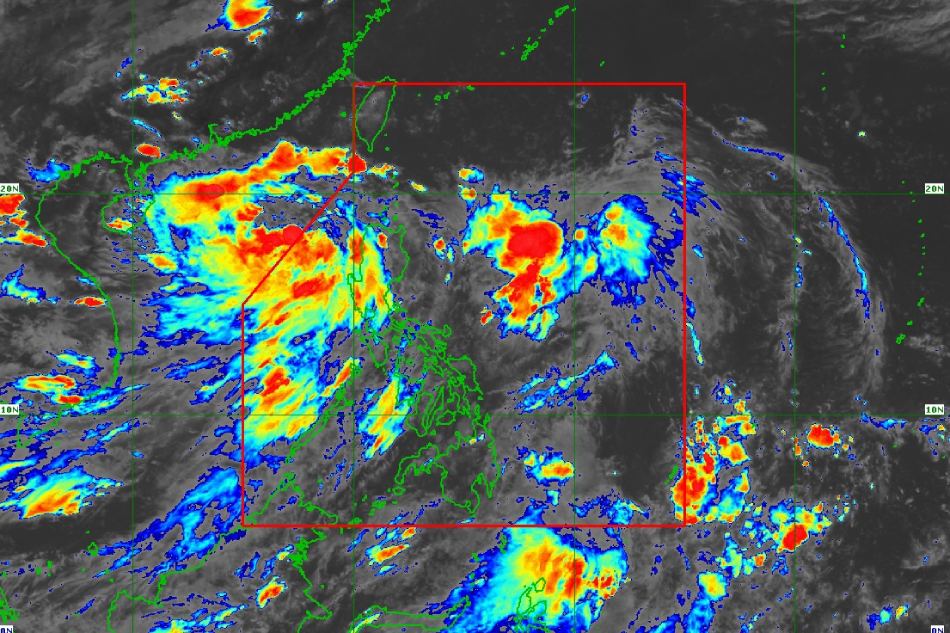
MANILA — The southwest monsoon or habagat will bring occasional to frequent rains over parts of the Philippines, with some Luzon areas forecast to experience heavy rains until early next week, the state weather bureau said, as tropical storm Dodong left the Philippine area of responsibility Saturday.
MANILA — The southwest monsoon or habagat will bring occasional to frequent rains over parts of the Philippines, with some Luzon areas forecast to experience heavy rains until early next week, the state weather bureau said, as tropical storm Dodong left the Philippine area of responsibility Saturday.
The storm's center was last seen 305 km west of Sinait, Ilocos Sur, according PAGASA's 4 p.m. bulletin.
The storm's center was last seen 305 km west of Sinait, Ilocos Sur, according PAGASA's 4 p.m. bulletin.
Dodong (international name Talim) is currently moving southeastward, packing sustained winds of 65 kilometers per hour and gustiness of up to 80 kilometers per hour at the center. It is projected to steadily intensify and become a typhoon on Monday.
Dodong (international name Talim) is currently moving southeastward, packing sustained winds of 65 kilometers per hour and gustiness of up to 80 kilometers per hour at the center. It is projected to steadily intensify and become a typhoon on Monday.
PAGASA earlier lifted all tropical cyclone wind signals on Saturday, even as Dodong strengthened into a tropical storm.
PAGASA earlier lifted all tropical cyclone wind signals on Saturday, even as Dodong strengthened into a tropical storm.
ADVERTISEMENT
The storm is projected to turn westward over the West Philippine Sea for the remainder of the forecast period.
The storm is projected to turn westward over the West Philippine Sea for the remainder of the forecast period.
For more updates, visit the ABS-CBN weather center.
For more updates, visit the ABS-CBN weather center.
Read More:
weather
weather news
weather top
tropical storm Dodong
PAGASA
Philippine area of responsibility
monsoon
southwest monsoon
habagat
rains
ADVERTISEMENT
ADVERTISEMENT


