Falcon further intensifies; rains in western Luzon for 3 days | ABS-CBN


ADVERTISEMENT

Welcome, Kapamilya! We use cookies to improve your browsing experience. Continuing to use this site means you agree to our use of cookies. Tell me more!
Falcon further intensifies; rains in western Luzon for 3 days
ABS-CBN News
Published Jul 31, 2023 07:05 AM PHT
|
Updated Jul 31, 2023 03:57 PM PHT
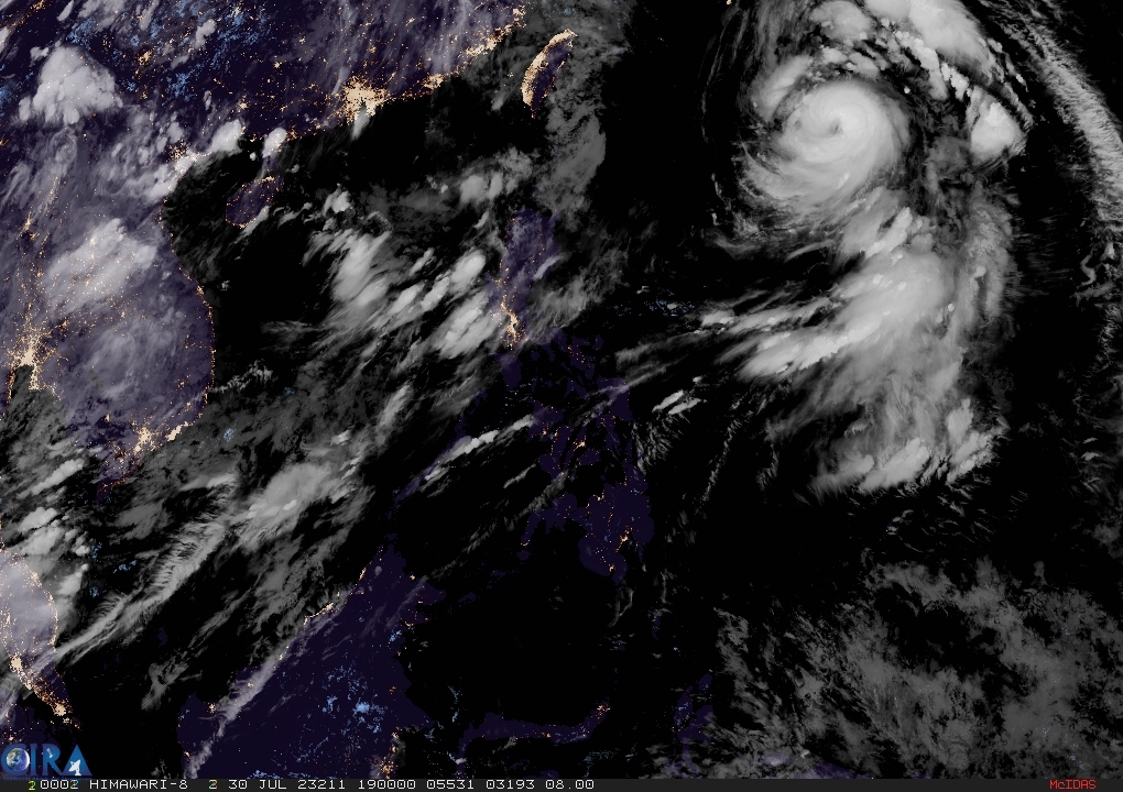
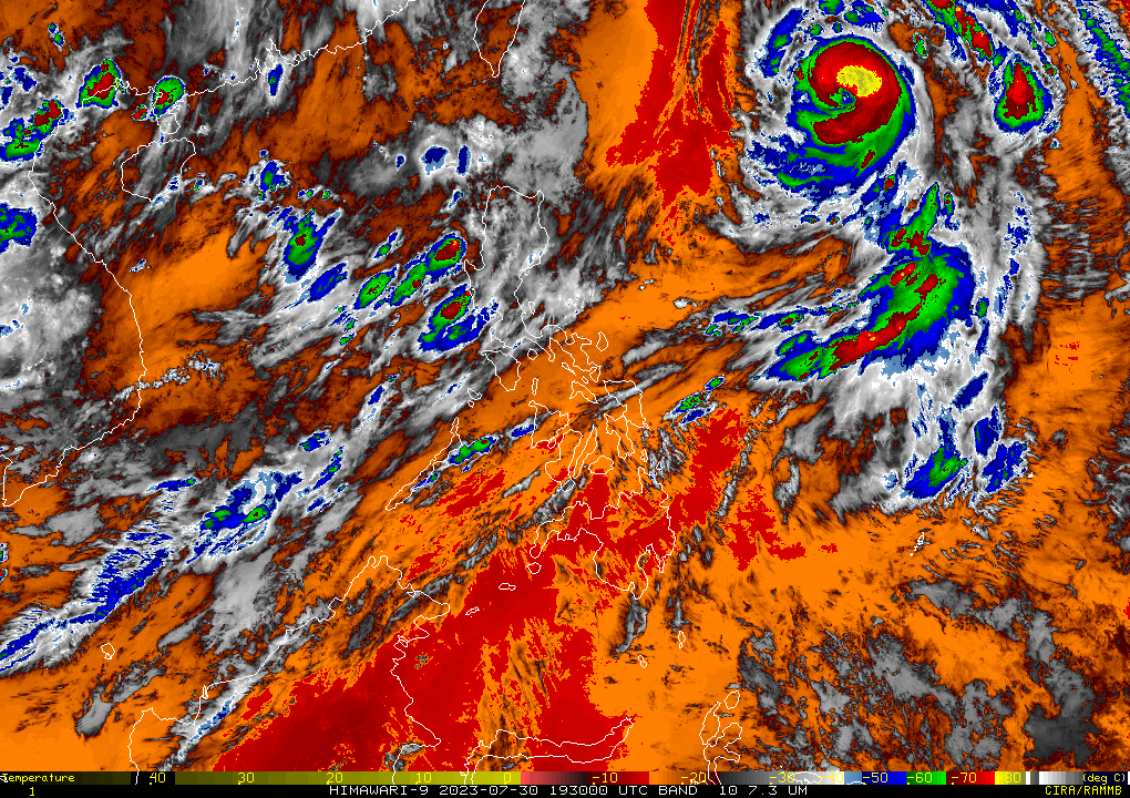
Typhoon Falcon has further intensified and may reach peak intensity by Tuesday or Wednesday while exiting the Philippines area of responsibility, weather bureau PAGASA said.
Typhoon Falcon has further intensified and may reach peak intensity by Tuesday or Wednesday while exiting the Philippines area of responsibility, weather bureau PAGASA said.
As of 4 a.m., the center of the eye of the typhoon was estimated based on all available data at 1,070 km east of Extreme Northern Luzon.
As of 4 a.m., the center of the eye of the typhoon was estimated based on all available data at 1,070 km east of Extreme Northern Luzon.
Packing 150 kph winds near the center and gusts of up to 185 kph, the typhoon is forecast to move north northwestward or northwestward Monday.
Packing 150 kph winds near the center and gusts of up to 185 kph, the typhoon is forecast to move north northwestward or northwestward Monday.
PAGASA said the southwest monsoon enhanced by Typhoon Falcon will bring occasional to monsoon rains over the western portion of Luzon in the next three days.
PAGASA said the southwest monsoon enhanced by Typhoon Falcon will bring occasional to monsoon rains over the western portion of Luzon in the next three days.
ADVERTISEMENT
The hoisting of wind signal due to Falcon over any locality in the country remains unlikely based on the current forecast scenario.
The hoisting of wind signal due to Falcon over any locality in the country remains unlikely based on the current forecast scenario.
However, the enhanced southwest monsoon will bring gusty conditions over the following areas, especially in coastal and upland/mountainous areas exposed to winds:
However, the enhanced southwest monsoon will bring gusty conditions over the following areas, especially in coastal and upland/mountainous areas exposed to winds:
- MONDAY: Zambales, Bataan, Cavite, Lubang Island, Kalayaan Islands, Cuyo Islands, Romblon, the northwestern portion of Antique, Camarines Sur, and Albay
- TUESDAY: Batanes, Babuyan Islands, Abra, Benguet, Zambales, Bataan, the central and southern portions of Aurora, Pampanga, Bulacan, Metro Manila, and most of Ilocos Region, CALABARZON, MIMAROPA, Bicol Region, and Western Visayas
- WEDNESDAY: Batanes, Babuyan Islands, Ilocos Region, Abra, Benguet, Aurora, Zambales, Bataan, Bulacan, Pampanga, Metro Manila, CALABARZON, MIMAROPA, Bicol Region, the western portion of Northern Samar, and most of Western Visayas
The southwest monsoon enhanced by Falcon will bring moderate to rough seas over the coastal waters along the northern (1.2 to 2.8 m), western (2.5 to 3.5 m) and southern (1.5 to 3.0 m) seaboards of Luzon.
The southwest monsoon enhanced by Falcon will bring moderate to rough seas over the coastal waters along the northern (1.2 to 2.8 m), western (2.5 to 3.5 m) and southern (1.5 to 3.0 m) seaboards of Luzon.
ADVERTISEMENT
ADVERTISEMENT