Jolina slightly weakens ahead of Batangas landfall: PAGASA


ADVERTISEMENT
Jolina slightly weakens ahead of Batangas landfall: PAGASA
ABS-CBN News
Published Sep 08, 2021 09:48 AM PHT
|
Updated Sep 08, 2021 11:58 AM PHT
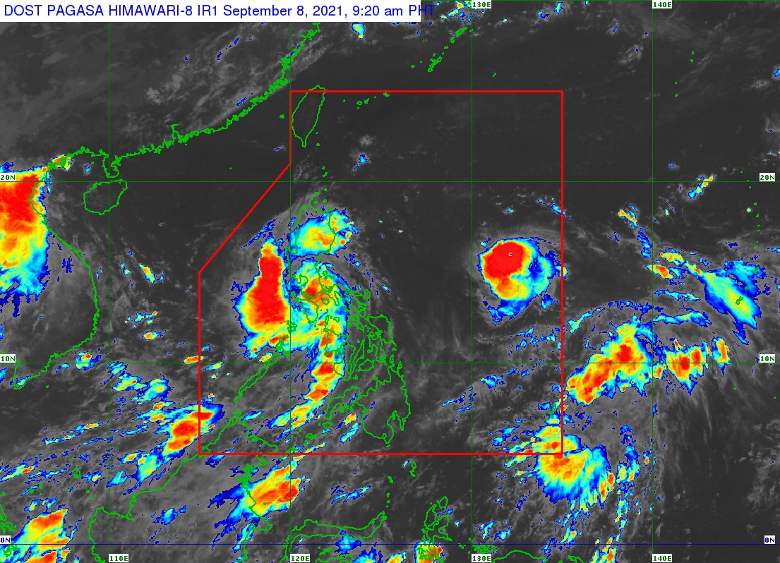
MANILA Severe tropical storm Jolina slightly weakened Wednesday morning prior to its expected landfall in Batangas, the state weather bureau said.
The country's 10th storm this year was last estimated over the coastal waters of San Juan, Batangas as of 7 a.m., moving west northwest at 15 km per hour while packing maximum winds of 95 kph and gusts of up to 115 kph, PAGASA said in its 8 a.m. bulletin.
In the next 24 hours, heavy to intense with at times torrential rains are expected over Metro Manila, Bataan, Romblon, Marinduque, Cavite, Laguna, Batangas, Rizal, Quezon, Camarines Norte, Occidental Mindoro, and Oriental Mindoro, according to the weather bureau.
Moderate to heavy with at times intense rains are also likely over Aurora, Bulacan, Nueva Ecija, Pampanga, Tarlac, Zambales, Camarines Sur, the northern portion of Palawan including Calamian and Cuyo Islands, Aklan, Antique, Capiz, Iloilo, Guimaras, and Negros Occidental, PAGASA added.
ADVERTISEMENT
Tropical cyclone wind signal no. 2, which warns of damaging gale-force to storm-force winds within 24 hours, was raised over the following areas:
- Metro Manila
- Marinduque
- northern and central portions of Oriental Mindoro
- northern and central portions of Occidental Mindoro including Lubang Islands
- central and southern portions of Quezon
- Batangas
- Cavite
- Laguna
- Rizal,
- southern portion of Bulacan
- Pampanga
- Bataan
- Zambales
- Tarlac
Tropical cyclone wind signal no. 1, which warns of strong winds prevailing within 24 hours, was raised over:
- La Union
- southern portion of Benguet
- southern portion of Nueva Vizcaya
- southern portion of Aurora
- Pangasinan
- Nueva Ecija
- rest of Bulacan
- rest of Quezon including Polillo Islands
- Camarines Norte
- western portion of Camarines Sur
- western portion of Romblon
- rest of Oriental Mindoro
- rest of Occidental Mindoro
The storm is forecast to make landfall in the vicinity of Lobo or San Juan in Batangas within the next 1 or 2 hours, after which it will cross the Batangas-Cavite area before emerging over the mouth of Manila Bay later Wednesday, PAGASA said.
This will be followed by another landfall in the vicinity of Bataan Peninsula, it added.
In the next 24 hours, storm surge of up to 1 meter over several coastal areas of Oriental Mindoro, Batangas and Quezon may result in coastal inundation which may pose threat to life and property, PAGASA warned.
Coastal areas of localities under storm signals may also experience coastal flooding due to hazardous surf conditions, it said.
"Jolina" is forecast forecast to exit the Philippine Area of Responsibility on Friday morning, it added.
Read More:
tropical storm Jolina
JolinaPH
PAGASA
Philippines weather
Philippines weather September 8 2021
Bagyo 2021
ADVERTISEMENT
ADVERTISEMENT