Welcome, Kapamilya! We use cookies to improve your browsing experience. Continuing to use this site means you agree to our use of cookies. Tell me more!
Typhoon Kiko likely to bring heavy to intense rains over N. Luzon
John Gabriel Agcaoili,
ABS-CBN News
Published Sep 09, 2021 06:57 PM PHT
PAGASA
MANILA - Typhoon Kiko is expected to bring heavy to intense rains over northern Luzon this week, the state weather bureau said Thursday.
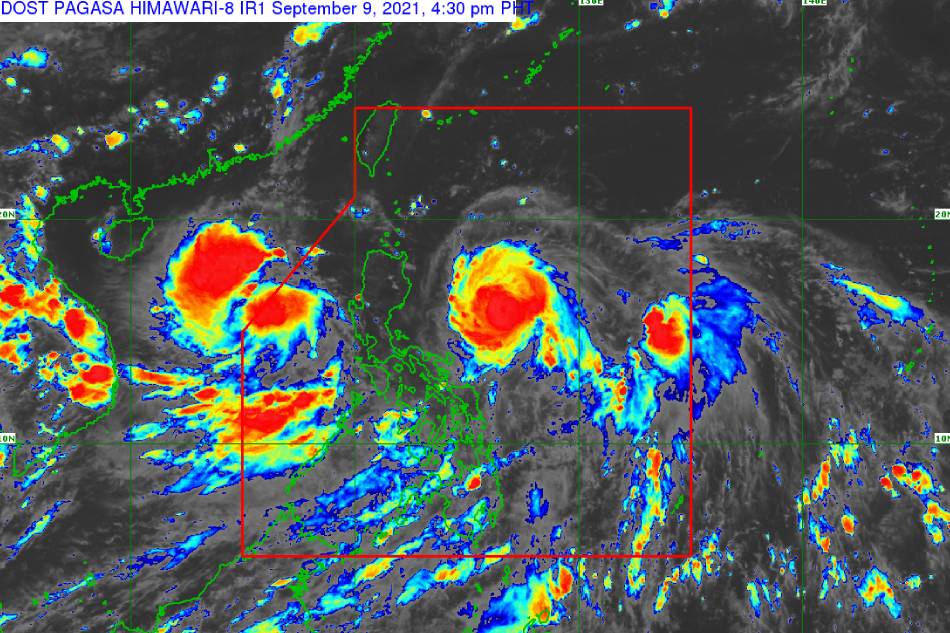
In its 5 p.m. weather bulletin, PAGASA said Kiko was last located 550 kilometers east of Baler, Aurora packing maximum sustained winds of 195 kph near the center with 240-kph gusts and winds extending 200 kms from the typhoon's center.
It was last seen moving west northwestward at 20 kph.
PAGASA said Kiko will likely bring heavy to intense with at times torrential rains over Cagayan including Babuyan Islands, Batanes, and northern Isabela starting Friday afternoon. Moderate to heavy with at times intense rains, meanwhile, may be experienced over the rest of Isabela.
ADVERTISEMENT
The agency warned of scattered to widespread flooding (including flash floods) and rain-induced landslides in affected areas.
Tropical cyclone wind signal no. 1, which warns of strong winds prevailing within 24 hours, is still hoisted over:
• Batanes • Cagayan including Babuyan Islands • Northeastern portion of Apayao (Luna, Pudtol, Flora, Santa Marcela) • Northeastern portion of Isabela (Santa Maria, San Pablo, Maconacon, Divilacan, Palanan)
PAGASA said winds reaching strong breeze to near gale strength with occasional gusts will be experienced in these areas.
"This may result (in) up to very light damage to structures and vegetation. However, it must be noted that as the typhoon progresses towards extreme northern Luzon, higher wind signals will be hoisted in some localities within Northern Luzon," the agency said.
ADVERTISEMENT
PAGASA said storm signal no. 4 is still the highest wind signal that may be hoisted for Kiko.
PAGASA
According to the agency, coastal inundation associated with high waves near the coast and storm surges may be experienced in several coastal municipalities and the eastern seaboard of northern Luzon, warning mariners against venturing out to sea.
"Due to the strength of this tropical cyclone, sea conditions over the aforementioned waters will further worsen tomorrow (Friday), making sea travel risky for all types of seacraft," it said.
The agency added that moderate to rough seas will be experienced over the northern seaboard of northern Luzon and the eastern seaboards of central and southern Luzon.
"Mariners of small seacraft are advised to take precautionary measures when venturing out to sea. Inexperienced mariners should avoid navigating in these conditions," it said.
Kiko is expected to track west-northwestward in the next 12 hours before turning generally northwestward until Saturday morning.
PAGASA said it is expected to pass very close to northeastern Cagayan and cross the vicinity of Babuyan Islands and Batanes between Friday afternoon and Saturday afternoon.
The weather bureau said it has not yet ruled out the possibility of Kiko's landfall over mainland Cagayan.
The typhoon is expected to leave the Philippine area of responsibility by Sunday afternoon and will move north-northeastward towards East China Sea.
Malacañang spokesman Harry Roque earlier said preparations for Kiko are underway.
"We ask the public to continue to remain alert and vigilant, take precautionary measures, observe minimum public health standards, and cooperate with their respective local authorities in case of an evacuation," he said in a statement.
ABS-CBN is the leading media and entertainment company in the Philippines, offering quality content across TV, radio, digital, and film. Committed to public service and promoting Filipino values, ABS-CBN continues to inspire and connect audiences worldwide.
Our website is made possible by displaying online
advertisements to our visitors. Please consider supporting
us by disabling your ad blocker on our website.
Our website is made possible by displaying online
advertisements to our visitors. Please consider supporting
us by disabling your ad blocker on our website.