Welcome, Kapamilya! We use cookies to improve your browsing experience. Continuing to use this site means you agree to our use of cookies. Tell me more!
‘Pepito’ intensifies into tropical storm, more areas under warning signals
Aleta Nieva Nishimori,
ABS-CBN News
Published Oct 20, 2020 12:47 PM PHT
|
Updated Oct 20, 2020 05:57 PM PHT
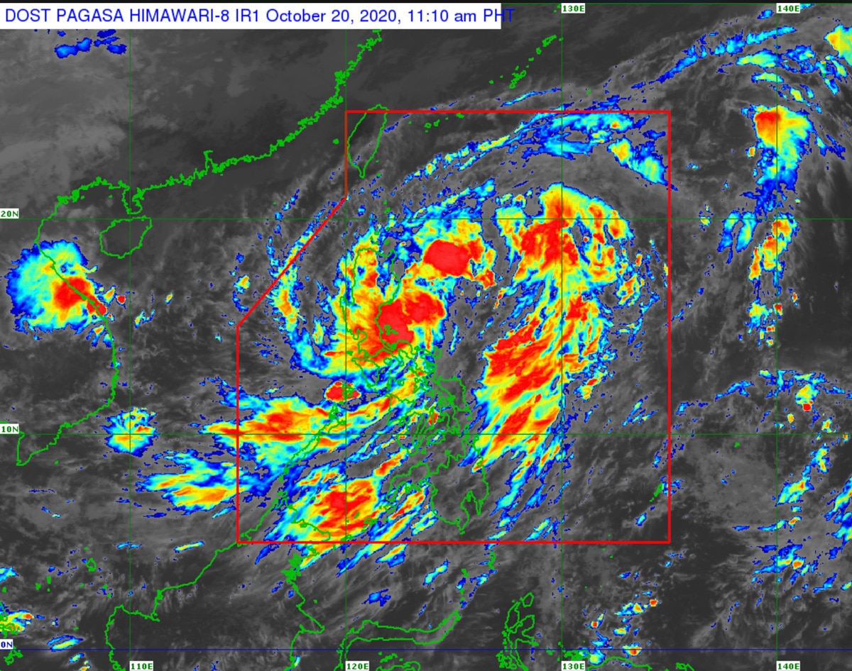
PAGASA
MANILA (UPDATE) - Weather system "Pepito" intensified into a tropical storm on Tuesday morning, prompting the weather bureau to place more areas under warning signals.
The country's 16th storm this year was last estimated 195 kilometers east of Baler, Aurora as of 1 p.m., moving west northwest at 25 kms per hour towards the Aurora-Isabela area, where it is forecast to hit land on Tuesday evening, PAGASA said in its latest weather bulletin.
Pepito, which is packing maximum sustained winds of 65 kph and gusts of up to 80 kph, is expected to intensify into a severe tropical storm and leave the Philippine area of responsibility by Thursday, PAGASA added.
On Tuesday, the storm will bring moderate to heavy rains over Bicol region, Mimaropa, Quezon, Aurora, Nueva Ecija, Nueva Vizcaya, Quirino, Isabela, mainland Cagayan, Pangasinan, and Benguet.
ADVERTISEMENT
Light to moderate with at times heavy rains will be experienced over Metro Manila and the rest of Luzon, Western Visayas, Zamboanga Peninsula, and Bangsamoro.
PAGASA warned that flooding, flashfloods and rain-induced landslides may occur during heavy or prolonged rainfall especially in areas that are highly or very highly susceptible to these hazards.
Tropical cyclone wind signal no. 2, where 61-120 kph winds were expected within 24 hours and may damage wooden and old electric posts, was hoisted over the following areas:
La Union
Ifugao
Benguet
Quirino
Pangasinan
Nueva Ecija
Nueva Vizcaya
Tarlac
Aurora
the southern portion of Isabela (Palanan, San Mariano, Benito Soliven, Naguilian, Gamu, Burgos, San Manuel, Aurora, Cabatuan, Luna, Reina Mercedes, Cauayan City, Dinapigue, San Guillermo, Angadanan, Alicia, San Mateo, Ramon, San Isidro, Echague, San Agustin, Jones, Santiago City, Cordon)
the southern portion of Ilocos Sur (Sugpon, Alilem, Tagudin)
the northern portion of Zambales (Iba, Palauig, Masinloc, Candelaria, Santa Cruz, Botolan, Cabangan)
the northern portion of Quezon (General Nakar) including Polillo Islands
Signal no. 1, where 30-60 kph winds may rip roofs off nipa and cogon huts, damage rice crops and down banana plants, was raised in:
Metro Manila
Abra
Kalinga
Mountain Province
Bulacan
Pampanga
Bataan
Rizal
the northern portion of Camarines Norte (Paracale, Jose Panganiban, Capalonga, Vinzons)
Catanduanes
the rest of the northern portion of Quezon (Infanta, Real)
the rest of Ilocos Sur
the rest of Isabela
the rest of Zambales
Meanwhile, a tropical depression last estimated 1,735 kms east northeast of extreme Northern Luzon, which has maximum sustained winds of 45 kph and gustiness of up to 55 kph, is less likely to enter PAR, said PAGASA.
ABS-CBN is the leading media and entertainment company in the Philippines, offering quality content across TV, radio, digital, and film. Committed to public service and promoting Filipino values, ABS-CBN continues to inspire and connect audiences worldwide.
Our website is made possible by displaying online
advertisements to our visitors. Please consider supporting
us by disabling your ad blocker on our website.
Our website is made possible by displaying online
advertisements to our visitors. Please consider supporting
us by disabling your ad blocker on our website.