Welcome, Kapamilya! We use cookies to improve your browsing experience. Continuing to use this site means you agree to our use of cookies. Tell me more!
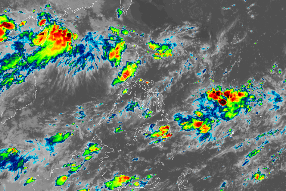
MANILA - Mindanao will continue to experience cloudy skies and scattered rains due to a weak southwest monsoon or habagat, the state weather bureau said Monday afternoon.
In its 24-hour public weather forecast, PAGASA said the habagat is still affecting Mindanao, and will bring scattered rains in the area.
Zamboanga peninsula, northern Mindanao and Bukidnon may experience scattered rainshowers and thunderstorms Monday night, but will stop by early Tuesday morning, weather forecaster Benison Estareja said.
Metro Manila and the rest of the country may also experience partly cloudy to cloudy skies with isolated rainshowers or thunderstorms, also due to the habagat and localized thunderstorms.
ADVERTISEMENT
Meanwhile, PAGASA is also monitoring a low pressure area east of extreme northern Luzon.
As of 3 p.m., it was located 860 km east northeast of extreme northern Luzon. It is less likely to develop into a storm within the next 24 hours.
The trough of the LPA will bring cloudy skies with scattered rainshowers and thunderstorms over Batanes and Babuyan Islands.
Another LPA east of Visayas outside the Philippine area of responsibility has already dissipated, but there is another LPA that formed farther from the location of the previous LPA, and it is not expected to move closer or affect the weather in the country.
PAGASA warned of possible flash floods or landslides due to moderate to at times heavy rains.
ABS-CBN is the leading media and entertainment company in the Philippines, offering quality content across TV, radio, digital, and film. Committed to public service and promoting Filipino values, ABS-CBN continues to inspire and connect audiences worldwide.
Our website is made possible by displaying online
advertisements to our visitors. Please consider supporting
us by disabling your ad blocker on our website.
Our website is made possible by displaying online
advertisements to our visitors. Please consider supporting
us by disabling your ad blocker on our website.